

Photo app and artificial intelligence facilitate subsidy area applications.
For years, EFTAS has taken over the remote sensing-based control of agricultural subsidy areas for many European countries as part of the Integrated Administration and Control System (IACS).
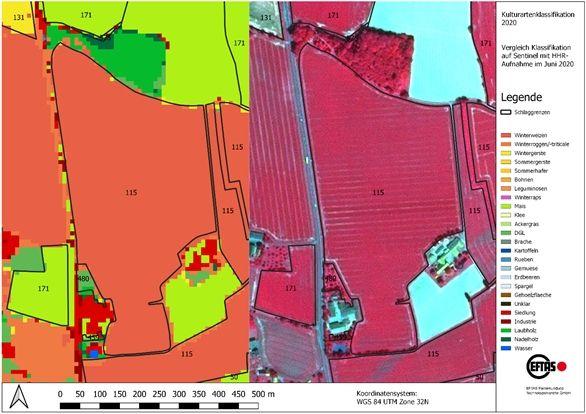
A current EU reform now requires a new area monitoring by the agricultural administrations of the countries. Previously, subsidy applications from around five percent of farms were checked. Starting this year, a check of all applicants must be carried out.
Satellite images for automated agricultural monitoring
The basis for an efficient check is provided by sentinel images from the European Copernicus program, which are available free of charge. Using time series of these satellite images, all areas are automatically checked for compliance with certain eligibility requirements, conditions and obligations. State-of-the-art technologies are used to evaluate the data stored on cloud systems with artificial intelligence. This is done by comparing the automated real land uses with the information provided by the farmers and either confirming the applications or indicating discrepancies.
Full automatic control is currently still limited by some technical constraints. Some uses cannot be distinguished in the satellite data, and the resolution of the satellite data is currently not sufficient especially for narrow areas. In these cases, the farmer will have to submit a digital photo of his land in the future.
EFTAS CropANALYZER – photo evaluation by AI
The digital photos of the application areas can be taken with a photo app, which was developed by the company GI Geoinformatik GmbH. Based on its many years of experience with field mapping and voucher photos, EFTAS has developed an application that allows automated evaluation of these images.
The EFTAS-CropANALYZER consists of a database with over 50,000 photos of agricultural uses and an artificial intelligence that automatically determines the depicted use. The smartphone’s position data stored with the photo can also be used to determine the photographer’s location and line of sight and match it with the location of the land in question.
From now on, the EFTAS CropANALYZER can be tested. The prototype web application allows the free use of an artificial neural network to determine agricultural crop types with photos from the field.
Test EFTAS CropANALYZER here:
–
–










