A multimodal deep learning method that automatically recognises individual trees – Jakob Danel represented EFTAS at SmartForest 2026 with this approach. On 12 and 13 March in Freising, he and Dr. Sebastian Mader presented how modern AI methods can make forest analysis more precise and efficient.
The event, held on the campus of the Technical University of Munich at the Weihenstephan Forest-Forestry-Wood Centre, brought together academia and industry to discuss digital, innovative and climate-adapted solutions for forest management.
Automated individual tree detection
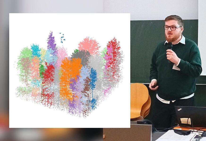
In the session „Forstpraxis 4.0 – KI für nachhaltige Forstwirtschaft“, Jakob Danel presented the results of his Master’s thesis on ‘Multimodal Deep Learning for Individual Tree Crown Segmentation’, which was carried out as part of an EFTAS project. In it, he investigated how high-resolution aerial photographs and 3D LiDAR data can be combined in a deep learning model to automatically recognise individual tree crowns.
The study shows that whilst it is possible to merge the two data sources, in practice this does not always lead to better results. Aerial photographs alone often provide very precise results. At the same time, it is clear that the full 3D structure provided by LiDAR offers valuable additional information and can be easily integrated into modern models. The study thus provides important insights into which data combinations are useful for future projects and how AI-supported tree segmentation can be efficiently integrated into forestry workflows.
Exchange between research and practice
Our EFTAS team took the opportunity whilst on site to attend further sessions and exchange ideas with users from forestry operations, public authorities and research institutions. The direct insight into the customer’s perspective was particularly valuable: What data do forestry authorities really need? How must results be presented so that they work in practice? And where do the biggest hurdles to digitalisation lie?
“The combination of theoretical approaches and specific practical requirements was very interesting for us,” says Jakob Danel. “You get a direct sense of which solutions are genuinely needed and how our results will later be used in the forest.”
SmartForest 2026 has once again demonstrated how important the exchange between research and practice is in making forests sustainable for the future. With our expertise in GeoIT, AI-supported analysis and field data acquisition, we will continue to help make forests more resilient and decisions more informed.
Photo:
Jakob Danel at Smart Forest 2026
Graphic:
Processing: Jakob Danel, EFTAS.
Data source: LIDAR point cloud 2023, Bayerische Staatsforsten.