Poster award for GIGASAR

City | TransportResearch | Consulting
Share this post:

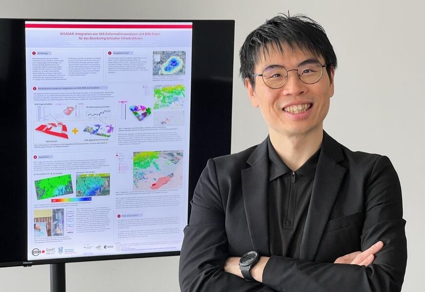
At the National Forum on Remote Sensing and Copernicus, held in Darmstadt at the end of April, the project poster by our colleague Dr Chia-Hsiang Yang from the German Aerospace Centre (DLR) was awarded the Poster Award!

🥳 🏅 Congratulations to Chia and his GIGASAR team!

The poster shows the innovative integration of SAR, BIM and geodata for the analysis of infrastructure movement. A fantastic recognition for a project that demonstrates how remote sensing and GeoIT can be used in a very practical way to monitor critical infrastructure!

Ground movements, such as those caused by mining, are often gradual but have far-reaching consequences. This is precisely where GIGASAR comes in:

The combination of satellite-based SAR deformation analyses using Sentinel-1 data, BIM models and geodata provides an integrated view of infrastructure and the changes it undergoes. The example of the town of Ahlen demonstrates how ground uplift can be precisely measured, linked to building information and analysed on a single platform. This provides a vital foundation for sustainable decision-making regarding our built environment!

“GIGASAR’s strength lies in the fact that we bring together different data sets, thereby opening up new perspectives on infrastructure trends,” summarises Chia-Hsiang Yang. “This enables us not only to measure changes, but also to understand and contextualise them more effectively.”

The forum itself once again demonstrated just how important professional exchange is within the EO community: fascinating presentations, the latest developments relating to Copernicus and many insightful discussions at the event made it clear just how firmly remote sensing has now become established in practical applications.

Many thanks to the whole GIGASAR team, and in particular to the Forschungszentrum Nachbergbau at the Technische Hochschule Georg Agricola Bochum

📍 Further information can be found on the project page: GIGASAR

Share this post:

Similar posts

Datenvisualisierung: Stadt Wuppertal
Stadtgrün als Basis für die Bundesgartenschau. Datenvisualisierung: Stadt Wuppertal

Up-to-date data for Wuppertal’s digital twin

29.09.2026

Remote sensing reveals changes in the tree inventory.

City | TransportGeospatial Data | Analysis | Acquisition

Digital twins are only as good as the geodata on which they are based!

01.09.2026

At INTERGEO (September 15–17, 2026, Munich), we’ll demonstrate how a reliable overall picture can be created from various data sources.

EventsGeospatial Data | Analysis | AcquisitionSoftware | Technology | Development

Ultraschwimmen 2026: A New Perspective at the Münster Harbor!

26.08.2026

This Saturday, for a change, we won’t be looking down at the water from above. That’s because the “Ultraschwimmen Münster 2026” will once again be taking place at the city harbor!

EventsTeam

Running with burning soles at the Campus Run!

29.06.2026

Our running team challenged the heat at the Leonardo Campus Run last week.

Team

ESA-ESRIN INSIGHT 2026: EFTAS presents GIGASAR

20.05.2026

New approaches to combining SAR monitoring, AI and BIM met great interest in Frascati.

Events

The European Conference for Biodiversity Monitoring

08.05.2026

In Montpellier EMBAL was part of the BioMonWeek 2026!In Montpellier war EMBAL Teil der BioMonWeek 2026!

Environment | NatureEventsGeospatial Data | Analysis | Acquisition

Satellite data for sustainable decisions

24.03.2026

EFTAS at the SustainableSolutionsMatch 2026

Environment | NatureEventsGeoIT-ServicesGeospatial Data | Analysis | Acquisition

Focus on AI-supported forest analysis

18.03.2026

EFTAS auf der SmartForest 2026

Agriculture | ForestryEventsGeoIT-ServicesGeospatial Data | Analysis | AcquisitionResearch | Consulting

Cop4ALL-DE is part of the German Government’s 6th “Geo-Fortschrittsbericht” (Geo Progress Report).

13.02.2026

The report outlines developments in the field of geoinformation.

GeoIT-ServicesGeospatial Data | Analysis | AcquisitionResearch | Consulting

Precise green space monitoring for climate-resilient cities

10.02.2026

EFTAS demonstrates an integrated approach combining remote sensing, AI and close-range photogrammetry

City | TransportDownloadGeospatial Data | Analysis | Acquisition

Subscribe to our newsletter.

Subscribe to our newsletter.