

EFTAS provides key reference data based on Copernicus
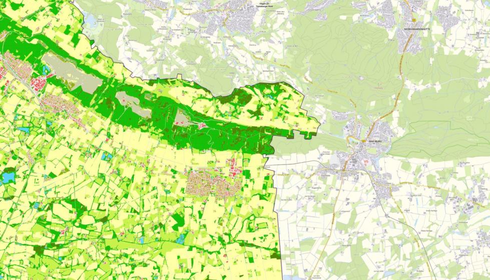
The ‘Land Cover Germany’ (LB – Landbedeckung Deutschland) WMS service for the year 2023 is now available. LB is a product of the federal and state surveying authorities and, for the first time, provides a comprehensive, non-overlapping and nationally standardised record of land cover at high spatial resolution – generated using the innovative Cop4ALL-DE method. The data is based on the AdV data model, which comprises 15 land cover classes, including buildings, civil engineering structures, various vegetation types and inland water bodies.
The LB product forms an important basis for numerous environmentally relevant issues – ranging from the analysis of the degree of soil sealing, through landscape and spatial planning, to climate simulations and reporting obligations to the European Commission.
Cop4ALL-DE: Software solution for data generation
The AI-based remote sensing method Cop4ALL-DE was used to derive land cover. The software solution was developed by the Münster-based company EFTAS, which, together with its project partner VertiGIS, has further developed the Cop4ALL-NRW method, originally trialled in North Rhine-Westphalia.
Cop4ALL-DE combines Sentinel-2 satellite imagery, digital orthophotos, ALKIS/ATKIS data and a normalised digital surface model (nDOM) to enable consistent, high-quality classification. The automated, AI-supported classification method enables consistent, up-to-date and high-quality land cover derivation for the whole of Germany. Starting in 2023, the land cover data will be updated annually.
Centralised distribution via the ZSGT
The Landbedeckung Deutschland 2025 data is provided centrally via the Zentrale Stelle Geotopographie (ZSGT) in accordance with the open data principle. In addition to the WMS service, the data is now also available for download, which facilitates its use in a wide range of applications.
Presentation at Intergeo 2025
Visitors to Intergeo 2025 in Frankfurt am Main will have the opportunity to learn more about the new WMS service „Landbedeckung Deutschland 2023“ (Land Cover Germany) and the underlying Cop4ALL-DE method at stand 0C029 in Hall 12, Level 0. EFTAS will be there to present current applications and demonstrate how land cover can be used as a key data foundation for digital twins and environmental analyses.
Further information is available directly from the BKG.










