

Peatlands are true climate protectors – provided they remain intact. However, around 95 per cent of Germany’s peatland areas have been drained and are now considered major sources of greenhouse gas emissions such as CO₂, N₂O and CH₄.
To better understand the actual contribution these areas make to climate change and to optimise restoration measures in a targeted manner, more precise measurement methods are required. This is precisely where the MoReNat-Q project, funded by the ‘Bundesministerium für Bildung und Forschung’, comes in – with innovations in quantum technology and photonics, in which EFTAS plays a central role.
Aerial laser measurement – combined with remote sensing expertise
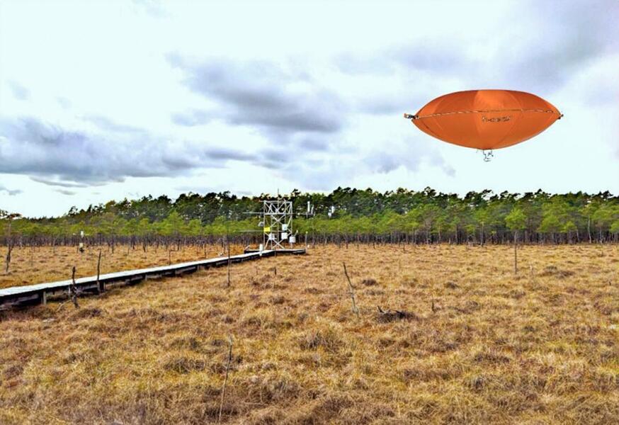
At the heart of the project is the development of an ultra-light, high-precision laser multi-sensor which, with the aid of a so-called LTA drone (Lighter Than Air UAV), flies over peatland areas and measures even the smallest concentrations of greenhouse gases. This new technology is set to enable, for the first time, the spatial resolution of emissions across large areas whilst complying with nature conservation requirements – even over extended periods. The aerial measurements will be compared with ground-based data and integrated into the analysis of various rewetting scenarios.
EFTAS is contributing its many years of experience in the field of remote sensing and the monitoring of ecological areas to the project. EFTAS’s peatland and Natura 2000 monitoring methods are not only complemented by the new technologies, but also serve as the methodological basis for extrapolating the point-based laser measurements across larger areas. Furthermore, EFTAS will prepare a pilot application of the developments in an initial selected test area.
Focus on practical application – EFTAS as the link to users
A particular strength of EFTAS in the MoReNat-Q project lies in the close integration of research and practice. As the link between development and future users, EFTAS is responsible for identifying the requirements of potential users at an early stage and guiding the project’s development accordingly. A planned workshop with relevant stakeholders will help to identify specific needs and ensure the future applicability of the results.
Real-world data for effective climate protection measures
Current estimates of greenhouse gas emissions from peatlands are often based on generalised assumptions. Through the planned large-scale measurements, the project hopes to obtain more realistic and nuanced data. In future, this could serve as an important basis for decision-making regarding restoration measures and funding programmes.
MoReNat-Q will run from September 2024 to August 2027. In addition to EFTAS, the project partners are nanoplus Advanced Photonics GmbH, the Institute for Landscape Ecology at the University of Münster, the Helmholtz Centre Potsdam (GFZ), Hybrid-Airplane Technologies GmbH and Hofer & Pautz. Together, they aim to make peatland restoration more efficient and climate-effective through modern quantum technology.
Further information on the project can be found here: Link










