

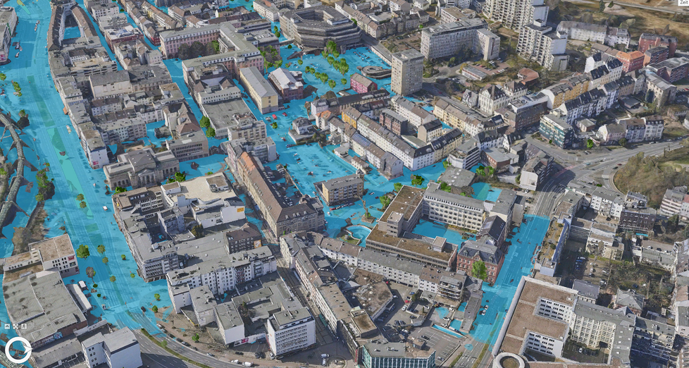
Digital twins are becoming an indispensable tool in more and more cities and municipalities for connecting the physical and virtual worlds. These digital representations of urban spaces enable the modeling, analysis, and prediction of urban structures and processes in real time.
Municipal digital twins are revolutionizing the way cities are managed and developed. They provide a basis for decision-making in urban planning, infrastructure projects, traffic management, climate adaptation measures, and many other areas of application. The continuous and precise updating of the underlying data plays a crucial role in identifying changes in the urban environment early on and responding to them effectively.
New Research Collaboration in Wuppertal
As part of the DigiTal Zwilling project, the City of Wuppertal has entered into a new research partnership in collaboration with EFTAS Fernerkundung Technologietransfer GmbH, the Institute for Technologies and Management of Digital Transformation (TMDT) at the University of Wuppertal, and the Fraunhofer Institute for Physical Measurement Techniques IPM. The goal of this research partnership is to develop and implement innovative methods for updating urban digital twins by fusing mobile mapping, remote sensing, and in situ data using artificial intelligence (AI).
Satellite Remote Sensing for Municipal Digital Twins
EFTAS contributes expertise in the processing of remote sensing data to the project, particularly with regard to Sentinel satellite data from the European Copernicus program. Using remote sensing methods, municipal geoinformation is updated precisely and regularly, providing an important foundation for the digital twin.
Our processes specifically include the inventory of urban structures, such as green spaces, tree locations, road infrastructure, and levels of soil sealing. We combine high-temporal-resolution remote sensing data with spatially precise geographic and contextual information about the city, as well as sensor data collected, for example, during vehicle surveys. In this way, we regularly generate up-to-date layers for the city of Wuppertal on specific topics for the respective departments.
In the future, these thematic layers could also be created on a nationwide basis in Germany. Continuous data updates would enable local governments to track spatial changes more easily and make relevant decisions more quickly and with greater confidence.
Collaboration for Innovative Solutions
In the DigiTal Zwilling Wuppertal project, we collaborate with several project partners. The City of Wuppertal provides the municipal data infrastructure and the DigiTal Zwilling, and ensures their integration into municipal processes. The University of Wuppertal is developing machine-readable data management structures. The Fraunhofer Institute for Physical Measurement Techniques (IPM) is contributing by conducting measurement campaigns using a sensor box and implementing AI-supported analysis of vehicle-based data for municipal data collection from a street-level perspective.
The newly established research collaboration will run through December 31, 2026. It has the potential to yield significant advances in basic research on the updating of urban digital twins. The insights gained will be of great benefit not only to Wuppertal but also to other municipalities, as they will facilitate the automated maintenance of urban digital twins. The partners will communicate the results of their research transparently and make them publicly available.










