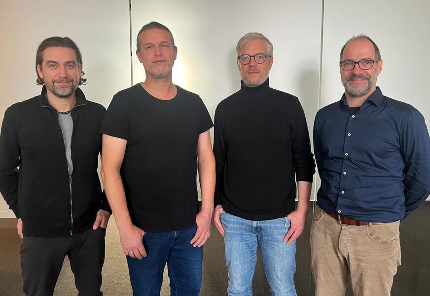
2 x 10 years at EFTAS: Agricultural parcels, a view of the fjord and camping in the Harz Mountains

Team
Share this post:
Contact person
In autumn, we at EFTAS celebrated the anniversaries of Sebastian Blecke and Nico Schültingkemper and raised a glass to two sets of ten years of GeoIT expertise!


Sebastian studied geography for his diploma and joined us at EFTAS after his first jobs in the fields of traffic flow analysis and agricultural administration. He initially started on a seasonal basis, carrying out checks on agricultural subsidies, and has been a permanent member of our team in this area since 2015. For many years, Sebastian also supported the Landesamt für Landwirtschaft und nachhaltige Landentwicklung (LLNL) in Kiel during the winter months as an ‘EFTAS external office’, entering reference plots into the agricultural land register there. “It wasn’t always easy to balance winter days by the Baltic Sea with life in Münster,” recalls Sebastian. “But the sweeping view from my window across the Kiel Fjord and the good rapport with the local team did make that time rather special.” Sebastian is now back working here in Münster on our agriculture and land-use projects, faithfully accompanied by ‘Eini’, his office unicorn.

Nico is also a qualified geographer and received a valuable tip from a friend ahead of his job interview with us: “That’s why I was able to answer straight away when asked what could be seen in the aerial photograph I was shown!” Nico recalls with a laugh. As you can see, this is how specialist knowledge and good networking go hand in hand! Nico started out digitising agricultural parcels in Schleswig-Holstein, followed later by further work in agricultural inspections, as well as jobs with other employers. For the LUCAS field surveys, he travelled around Minden and the Harz Mountains, sometimes even staying in a tent. Nico has been a permanent member of the EFTAS team since 2015. Today, he leads teams for agricultural subsidy inspections and delivers training courses. And whenever a World Cup or European Championship is coming up, Nico, with his passion for football, organises the EFTAS betting game!

It’s great to have you both on the team. Thank you for your ideas and your dedication! We look forward to many more years with you!


Share this post:

Similar posts

Ultraschwimmen 2026: A New Perspective at the Münster Harbor!

26.08.2026

This Saturday, for a change, we won’t be looking down at the water from above. That’s because the “Ultraschwimmen Münster 2026” will once again be taking place at the city harbor!

EventsTeam

Running with burning soles at the Campus Run!

29.06.2026

Our running team challenged the heat at the Leonardo Campus Run last week.

Team

ESA-ESRIN INSIGHT 2026: EFTAS presents GIGASAR

20.05.2026

New approaches to combining SAR monitoring, AI and BIM met great interest in Frascati.

Events

The European Conference for Biodiversity Monitoring

08.05.2026

In Montpellier EMBAL was part of the BioMonWeek 2026!In Montpellier war EMBAL Teil der BioMonWeek 2026!

Environment & NatureEventsGeospatial Data, Analysis & Acquisition

Poster award for GIGASAR

07.05.2026

Award for the innovative integration of SAR, BIM, and geospatial data for infrastructure movement analysis.

City & Transport

Satellite data for sustainable decisions

24.03.2026

EFTAS at the SustainableSolutionsMatch 2026

Environment & NatureEventsGeoIT-ServicesGeospatial Data, Analysis & Acquisition

Focus on AI-supported forest analysis

18.03.2026

EFTAS auf der SmartForest 2026

Agriculture & ForestryEventsGeoIT-ServicesGeospatial Data, Analysis & AcquisitionResearch & Consulting

Cop4ALL-DE is part of the German Government’s 6th “Geo-Fortschrittsbericht” (Geo Progress Report).

13.02.2026

The report outlines developments in the field of geoinformation.

GeoIT-ServicesGeospatial Data, Analysis & AcquisitionResearch & Consulting

Precise green space monitoring for climate-resilient cities

10.02.2026

EFTAS demonstrates an integrated approach combining remote sensing, AI and close-range photogrammetry

City & TransportDownloadGeospatial Data, Analysis & Acquisition

GIGASAR: The trend topic ‘Precise infrastructure monitoring’

29.01.2026

New opportunities through the fusion of BIM and SAR data in ESA project.

City & TransportGeoIT-ServicesGeospatial Data, Analysis & AcquisitionMining & Geo-ResourcesProjectsResearch & Consulting

Subscribe to our newsletter.

Subscribe to our newsletter.








