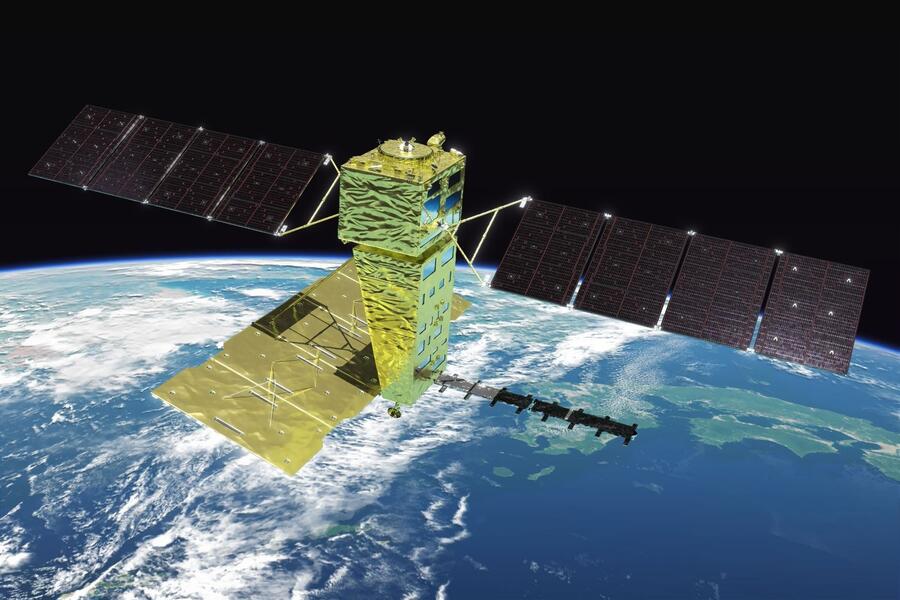
Satellit ALOS-4 im Weltraum

ALOS-4 takes off

Geospatial Data, Analysis & Acquisition
Share this post:
Contact person

New satellite data available from EFTAS

ALOS-4, a new Earth observation satellite providing L-band radar data, has recently become available. From April 2025, EFTAS Fernerkundung Technologietransfer GmbH will take over the distribution of ALOS-4 data for the German market – in cooperation with the Japanese provider PASCO.

New opportunities for remote sensing and analysis

ALOS-4 is the successor to the ALOS-1 and ALOS-2 satellites and offers improved spatial resolution and larger coverage areas in comparison. The system is equipped with an L-band radar sensor that operates independently of light and weather conditions. This makes ALOS-4 suitable for a wide range of applications, including environmental monitoring, land-use mapping, infrastructure monitoring and risk analysis.

L-band radar complements existing data sources

A particular advantage of L-band radar lies in its ability to provide information even in areas of dense vegetation or under difficult weather conditions. The data can be used, for example, for deformation analysis, to detect ground subsidence and changes in soil moisture, or to map forest structure. When combined with optical imagery, this creates a robust data foundation for analyses at local, regional or national level.

Partnership with PASCO

EFTAS has been working with PASCO for many years and is now taking over the distribution of ALOS-4 data in Germany. At the same time, the operating contract for ALOS-2 has been extended – whilst the data quality of ALOS-4 has improved significantly, ALOS-2 data remains attractive, particularly for cost-sensitive commercial applications. Demand is expected to remain high worldwide until the end of the ALOS-2 mission.

In addition to providing data, we also offer support in selecting the appropriate data, processing it and integrating it into existing geodata infrastructures. With ALOS-4, our range of satellite data is expanded to include a versatile system that opens up new possibilities for applications in public administration, research and business.

Foto: Advanced Land Observing Satellite-4 (ALOS-4) © JAXA

Share this post:

Similar posts

Ultraschwimmen 2026: A New Perspective at the Münster Harbor!

26.08.2026

This Saturday, for a change, we won’t be looking down at the water from above. That’s because the “Ultraschwimmen Münster 2026” will once again be taking place at the city harbor!

EventsTeam

Running with burning soles at the Campus Run!

29.06.2026

Our running team challenged the heat at the Leonardo Campus Run last week.

Team

ESA-ESRIN INSIGHT 2026: EFTAS presents GIGASAR

20.05.2026

New approaches to combining SAR monitoring, AI and BIM met great interest in Frascati.

Events

The European Conference for Biodiversity Monitoring

08.05.2026

In Montpellier EMBAL was part of the BioMonWeek 2026!In Montpellier war EMBAL Teil der BioMonWeek 2026!

Environment & NatureEventsGeospatial Data, Analysis & Acquisition

Poster award for GIGASAR

07.05.2026

Award for the innovative integration of SAR, BIM, and geospatial data for infrastructure movement analysis.

City & Transport

Satellite data for sustainable decisions

24.03.2026

EFTAS at the SustainableSolutionsMatch 2026

Environment & NatureEventsGeoIT-ServicesGeospatial Data, Analysis & Acquisition

Focus on AI-supported forest analysis

18.03.2026

EFTAS auf der SmartForest 2026

Agriculture & ForestryEventsGeoIT-ServicesGeospatial Data, Analysis & AcquisitionResearch & Consulting

Cop4ALL-DE is part of the German Government’s 6th “Geo-Fortschrittsbericht” (Geo Progress Report).

13.02.2026

The report outlines developments in the field of geoinformation.

GeoIT-ServicesGeospatial Data, Analysis & AcquisitionResearch & Consulting

Precise green space monitoring for climate-resilient cities

10.02.2026

EFTAS demonstrates an integrated approach combining remote sensing, AI and close-range photogrammetry

City & TransportDownloadGeospatial Data, Analysis & Acquisition

GIGASAR: The trend topic ‘Precise infrastructure monitoring’

29.01.2026

New opportunities through the fusion of BIM and SAR data in ESA project.

City & TransportGeoIT-ServicesGeospatial Data, Analysis & AcquisitionMining & Geo-ResourcesProjectsResearch & Consulting

Subscribe to our newsletter.

Subscribe to our newsletter.









