Digital twins in the spotlight

City & TransportEventsTeam
Share this post:
Contact person
That was Intergeo 2025!

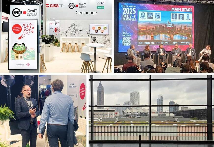
From 7 to 9 October 2025, Frankfurt am Main hosted Intergeo – the leading international trade fair for geodesy, geoinformation and land management. Right at the heart of the exhibition was our joint stand in Hall 12, which proved to be a vibrant hub for discussion, innovation and practical applications.

Together with our stand partners, we presented a wide range of topics relating to remote sensing and geodata. Our team focused on digital twins, AI-supported geodata processing and practical solutions to current challenges in administration, planning and research.

There was particular interest in the ‘DigiTal Zwilling Wuppertal’, in which we map urban structures in real time by merging remote sensing, mobile mapping and sensor data. Our high-resolution 3D data based on aerial photographs also met with a very positive response, as it forms an important basis for realistic digital twins in both urban and rural areas. With the Cop4ALL-DE project, we demonstrated how ADV-compliant land cover data can be generated using AI and in a standardised manner across the whole of Germany – a valuable foundation for cadastral surveys, spatial and environmental planning, and monitoring.

The potential applications of our solutions are wide-ranging: flood and heavy rainfall management, civil protection, environmental safety, mining, agriculture and forestry – all of these were discussed in depth at the stand. The discussions were practical, forward-looking and full of inspiration.

“Intergeo 2025 demonstrated just how strong the interest is in practical applications for digital twins,” emphasises Olaf Büscher, Managing Director of EFTAS. “Our AI-supported approaches, which enable a new level of quality in geodata processing and create genuine added value for local authorities and specialist users, were in particularly high demand.”

With many exciting interactions, a clear focus on local government practice and a strong community presence, Intergeo 2025 was a resounding success for us and another step towards smarter, connected geodata solutions for the future.


Share this post:

Similar posts

Ultraschwimmen 2026: A New Perspective at the Münster Harbor!

26.08.2026

This Saturday, for a change, we won’t be looking down at the water from above. That’s because the “Ultraschwimmen Münster 2026” will once again be taking place at the city harbor!

EventsTeam

Running with burning soles at the Campus Run!

29.06.2026

Our running team challenged the heat at the Leonardo Campus Run last week.

Team

ESA-ESRIN INSIGHT 2026: EFTAS presents GIGASAR

20.05.2026

New approaches to combining SAR monitoring, AI and BIM met great interest in Frascati.

Events

The European Conference for Biodiversity Monitoring

08.05.2026

In Montpellier EMBAL was part of the BioMonWeek 2026!In Montpellier war EMBAL Teil der BioMonWeek 2026!

Environment & NatureEventsGeospatial Data, Analysis & Acquisition

Poster award for GIGASAR

07.05.2026

Award for the innovative integration of SAR, BIM, and geospatial data for infrastructure movement analysis.

City & Transport

Satellite data for sustainable decisions

24.03.2026

EFTAS at the SustainableSolutionsMatch 2026

Environment & NatureEventsGeoIT-ServicesGeospatial Data, Analysis & Acquisition

Focus on AI-supported forest analysis

18.03.2026

EFTAS auf der SmartForest 2026

Agriculture & ForestryEventsGeoIT-ServicesGeospatial Data, Analysis & AcquisitionResearch & Consulting

Cop4ALL-DE is part of the German Government’s 6th “Geo-Fortschrittsbericht” (Geo Progress Report).

13.02.2026

The report outlines developments in the field of geoinformation.

GeoIT-ServicesGeospatial Data, Analysis & AcquisitionResearch & Consulting

Precise green space monitoring for climate-resilient cities

10.02.2026

EFTAS demonstrates an integrated approach combining remote sensing, AI and close-range photogrammetry

City & TransportDownloadGeospatial Data, Analysis & Acquisition

GIGASAR: The trend topic ‘Precise infrastructure monitoring’

29.01.2026

New opportunities through the fusion of BIM and SAR data in ESA project.

City & TransportGeoIT-ServicesGeospatial Data, Analysis & AcquisitionMining & Geo-ResourcesProjectsResearch & Consulting

Subscribe to our newsletter.

Subscribe to our newsletter.








