Reforestation in focus

Agriculture & ForestryGeospatial Data, Analysis & AcquisitionProjectsSoftware, Technology & Development
Share this post:
Contact person
EFTAS further develops monitoring procedures for Waldinfo.NRW

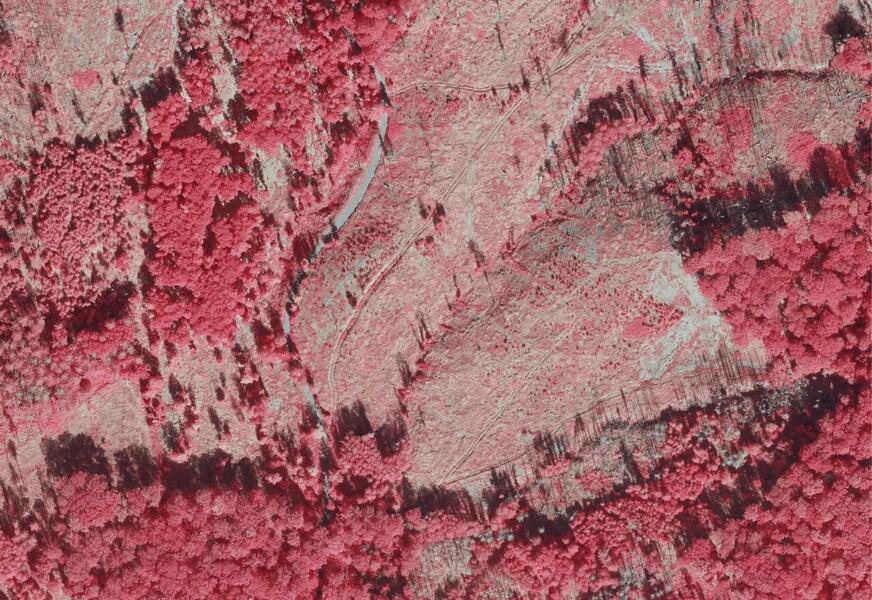
How well are forests in North Rhine-Westphalia recovering after the massive damage of recent years? And where is reforestation already taking place – whether through afforestation or natural succession? These questions are the focus of a new research and development project involving Wald und Holz NRW, con terra GmbH, and EFTAS.

EFTAS is on board as a remote sensing expert and is contributing its many years of monitoring experience to the project development. The project is being carried out on behalf of the Ministry of Agriculture and Consumer Protection of the State of North Rhine-Westphalia.

From damage monitoring to reforestation recording

With the new focus on “reforestation monitoring,” the scope is now expanding. –

The goal is to use remote sensing to systematically record reforestation on former disaster areas—regardless of whether this is achieved through afforestation or natural processes.

Kleine Pflanzen, große Herausforderung

Young trees in particular are difficult to detect using remote sensing – a key challenge in the development of the new monitoring system. Based on initial preliminary tests, EFTAS will design a method based on satellite data and supplementary archive and location data. A prototype will then be developed and the process tested on large-scale test areas.

Together with relevant stakeholders such as the North Rhine-Westphalia State Forestry and Timber Agency, the aim is to develop a standardizable method that is likely to be of interest beyond the state’s borders in the long term.

Next step: From data collection to recommendations for action

In the long term, monitoring should not only make the status of reforestation visible, but also help to derive targeted measures – for example, to support natural regeneration or to plan effective reforestation. The project thus makes an important contribution to climate-resilient forest development in North Rhine-Westphalia.


Share this post:

Similar posts

Ultraschwimmen 2026: A New Perspective at the Münster Harbor!

26.08.2026

This Saturday, for a change, we won’t be looking down at the water from above. That’s because the “Ultraschwimmen Münster 2026” will once again be taking place at the city harbor!

EventsTeam

Running with burning soles at the Campus Run!

29.06.2026

Our running team challenged the heat at the Leonardo Campus Run last week.

Team

ESA-ESRIN INSIGHT 2026: EFTAS presents GIGASAR

20.05.2026

New approaches to combining SAR monitoring, AI and BIM met great interest in Frascati.

Events

The European Conference for Biodiversity Monitoring

08.05.2026

In Montpellier EMBAL was part of the BioMonWeek 2026!In Montpellier war EMBAL Teil der BioMonWeek 2026!

Environment & NatureEventsGeospatial Data, Analysis & Acquisition

Poster award for GIGASAR

07.05.2026

Award for the innovative integration of SAR, BIM, and geospatial data for infrastructure movement analysis.

City & Transport

Satellite data for sustainable decisions

24.03.2026

EFTAS at the SustainableSolutionsMatch 2026

Environment & NatureEventsGeoIT-ServicesGeospatial Data, Analysis & Acquisition

Focus on AI-supported forest analysis

18.03.2026

EFTAS auf der SmartForest 2026

Agriculture & ForestryEventsGeoIT-ServicesGeospatial Data, Analysis & AcquisitionResearch & Consulting

Cop4ALL-DE is part of the German Government’s 6th “Geo-Fortschrittsbericht” (Geo Progress Report).

13.02.2026

The report outlines developments in the field of geoinformation.

GeoIT-ServicesGeospatial Data, Analysis & AcquisitionResearch & Consulting

Precise green space monitoring for climate-resilient cities

10.02.2026

EFTAS demonstrates an integrated approach combining remote sensing, AI and close-range photogrammetry

City & TransportDownloadGeospatial Data, Analysis & Acquisition

GIGASAR: The trend topic ‘Precise infrastructure monitoring’

29.01.2026

New opportunities through the fusion of BIM and SAR data in ESA project.

City & TransportGeoIT-ServicesGeospatial Data, Analysis & AcquisitionMining & Geo-ResourcesProjectsResearch & Consulting

Subscribe to our newsletter.

Subscribe to our newsletter.








